Soon after formation the Earth would have had fresh water and continents

Ancient zircon crystals contain chemical clues that fresh water may have existed on Earth soon after its formation.

robot's profile picture
Published in 
 · 16 May 2024
Soon after formation the Earth would have had fresh water and continents
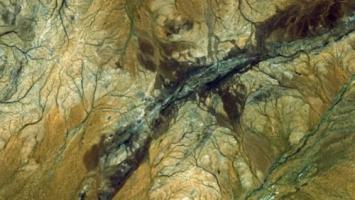
Earth's first continents may have emerged from the planet's primordial oceans much earlier than we thought, as little as six hundred million years after the planet formed, new research suggests. Ancient zircon crystals from the Jack Hills in Western Australia contain evidence of fresh water, indicating that areas of land must have been present as fresh water can only form if there is land to later collect to precipitation. The team described the zircons at a European Geosciences Union conference in April 2024. The composition of early Earth has long puzzled scientists. When our planet first formed, 4.6 billion years ago, it was a ...

The mystery of the wishing stone in the Hittite Empire

The nephrite monolith in the Great Temple of Hattusa: possible religious meanings and unsolved mysteries.

lostcivilizations's profile picture
Lost Civilizations (@lostcivilizations)
Published in 
 · 16 May 2024
The stone is made of nephrite.
In the remains of the Great Temple of Hattusa, located in modern-day Turkey, there is an interesting peculiarity: an imposing nephrite monolith carved in the shape of a cube. This stone, known as the “wishing stone ” by local inhabitants, was found among the remains of the Hittite empire, which established itself in the region around 2000 BC, emerging as one of the dominant powers of the Middle East by 1340 BC. The Hittite capital, Hattusa, reached its peak with an estimated population of 40,000 to 50,000 people and was characterized by numerous temples, royal residences and impressive fortifications. However, over the course of several d...

The Bura Asinda civilization

lostcivilizations's profile picture
Lost Civilizations (@lostcivilizations)
Published in 
 · 16 May 2024
The Bura Asinda civilization
Geography The splendid Bura terra cotta pieces originate from what is now Burkina Faso, the name Bura coming from the burial ground where the first archaeological pieces were found. Asinda and Sikka are two more precise locations, inside this larger excavation area. Burkina, or Burkina Faso in its long form, was formerly called the Upper Volta. It is a landlocked country in West Africa whose name in French means "country of the just men". The country is inhabited by the Burkinabé, a word which designates the inhabitant, male or female, in the Foulfouldé language spoken by the Peuls, a population of nomadic stock breeders throughout West ...

The Djenné civilization

lostcivilizations's profile picture
Lost Civilizations (@lostcivilizations)
Published in 
 · 16 May 2024
The Djenné civilization
Geography Djenné ceramics come from Mali which has a surface area of more than 1,200,000 km², which is about twice the size of France. The north and the center of the country are practically Saharan: arid, dry and endemically suffering from drought. These are areas of nomadic cattle-raising (bovine, especially ovine and caprine) whose very poor economy suffers from the absence of maritime outlets and, with the exception of some gold lodes, an almost total lack of mineral resources. The more humid south benefits from the Senegal and Niger river valleys where agricultural output is greater, principally fine quality millet, rice, sorghum, a...

The Koma civilization

lostcivilizations's profile picture
Lost Civilizations (@lostcivilizations)
Published in 
 · 16 May 2024
The Koma civilization
Geography Ghana is a west African country located on the Gulf of Guinea, just north of the equator. It shares a border with the Ivory Coast to the west, Togo to the east and Burkina Faso to the north. Ghana owes its former name, Gold Coast, to the large amount of gold to be found in the country. Before being exploited by the British, German, Dutch and French colonists, this gold was used abundantly by the Ashanti ethnic group, supporting their tradition of splendid gold jewelry, a tradition also propagated by the neighboring Baoulé ethnic group. The country consists of dense tropical forests in the south, and the savanna in the north. It...

The Sao civilization

lostcivilizations's profile picture
Lost Civilizations (@lostcivilizations)
Published in 
 · 16 May 2024
The Sao civilization
Geography Chad is a landlocked country in central Africa, located to the south of Libya, to the east of Niger and Nigeria, to the north of Cameroon and the Central African Republic, and to the west of Sudan. The modern borders are remnants of European colonialism; the result of negotiations between the French, English and Germans in the 1880s. But this area called Chad has a rich and relatively well-known history. The first homonid remains were found there as part of the recent "Toumaï" discovery, and it is undoubtedly one of the cradles of humanity. It has also been the seat of three large saharan kingdoms: the Kanem Bornou, the Baguirm...

The Akan civilization

lostcivilizations's profile picture
Lost Civilizations (@lostcivilizations)
Published in 
 · 16 May 2024
The Akan civilization
Geography The Akan are a group of peoples (Ashanti, Baoulé, Anyi, Attié, etc.) who live in southern Ghana and in the south-east of the Ivory Coast. For a geographical presentation of Ghana, please refer to the Sao section. The Ivory Coast is a country in West Africa bordering the countries of Liberia, Guinea, Mali, Burkina Faso, and Ghana. It has a population of 17 million and is a member of the African Union. Its capital, Yamoussoukro, is situated in the center of the country. Other principal cities are Abidjan and San Pedro, on the Gulf of Guinea, and Bouaké, also in the center. The population is very young: 48,2% are under the age of ...

The Nok civilization

lostcivilizations's profile picture
Lost Civilizations (@lostcivilizations)
Published in 
 · 16 May 2024
Nigeria map
Geography Modern Nigeria has a population of 140 million and is situated on the Gulf of Guinea bordered by the Atlantic Ocean. There are 4,047 km of land borders, and 853 km of shoreline. It is bordered to the west by Benin (773 km), to the east by Cameroon (1,690 km), to the north by Niger (1,497 km) and by Chad to the north-east (84 km). The Southern part of the country where a majority of the important villages are located has an equatorial climate. The capital, Lagos is one of the biggest cities in the world. The Central part of the country is made up of savannas and plateaus. It is in this area of the country that the highest point,...

Yfjug

AniphaeS's profile picture
Published in 
 · 14 May 2024
Yfjug
,🇬🇧 🌟 4-Ingredient Yogurt Cloud Cake! 🌟 👩‍🍳 INGREDIENTS : 4 Eggs 70 g of Brown Sugar 50 g of Cornstarch 300 g of Greek Yogurt 👨‍🍳 PREPARATION : In a large bowl, mix the yolks with the sugar and yogurt using a hand whisk until you achieve a smooth and creamy mixture. Add sifted cornstarch and mix carefully until all ingredients are fully incorporated. In a separate bowl, beat the egg whites until stiff peaks form and fold them into the previously prepared mixture, mixing gently from the bottom up to avoid deflating the egg whites and keeping the batter light. Pour the batter into an 18 cm diameter cake pan, previously lined with parc...
loading
New to Neperos ? Sign Up for free
download Neperos App from Google Play
install Neperos as PWA

Recent Articles

Recent Comments

Neperos cookies
This website uses cookies to store your preferences and improve the service. Cookies authorization will allow me and / or my partners to process personal data such as browsing behaviour.

By pressing OK you agree to the Terms of Service and acknowledge the Privacy Policy

By pressing REJECT you will be able to continue to use Neperos (like read articles or write comments) but some important cookies will not be set. This may affect certain features and functions of the platform.
OK
REJECT