The impossible maps
In 1492 Christopher Columbus departed from the port of Palos, destination the Indies, but his route would be unusual; he would always go westward, circling that world hitherto thought to be flat.
But let us start a few years earlier, when the young Columbus traveled to Ireland, in search of evidence to confirm his theory, where he studied the charts and writings of the Vikings, a proud seafaring people. Aboard their Drakkars they had visited the most remote lands of the known world, and, it seems, even those unknown at the time.
There is in fact a charming town in America that every year celebrates its founding with Viking costumes, archaeologists have discovered the remains of a Viking village that would confirm the presence of the northern people in those lands. They crossed the Atlantic in their ships, stopping in Iceland and Groelland to reach the green American plains where they most likely clashed with Native Americans.
But then, why is it only today that it is admitted that they were the first to set foot in America, and yet America continues to celebrate Columbus Day?
"Columbus discovered America? But we already knew it, it was our land all along, our mother." Native Americans have always lived in those places, whose history for us begins only 200 years ago.
Columbus thus had a chance to consult the Viking records, so he knew exactly what he would find. Also back in Europe he had the opportunity to observe another impossible object, the world map of Paolo dal Pozzo Toscanelli. A world map complete in every detail, accurate even in measuring distances.
Columbus and his commanders knew what they would find and where, they carefully chose their route and landing points.
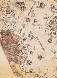
But were the Vikings really the first to reach America? Pirì Reis Ibn Haja Mehemet admiral of the Ottoman Empire who lived around 1500; a proven historical figure, he left a map dated 1513 in which the coasts of Europe, Africa, and the Americas are visible.
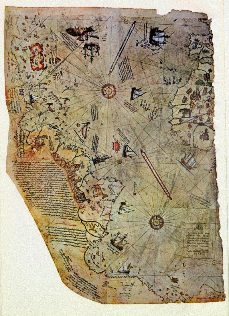

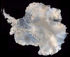
But even more incredible is the detail in which the coastline of Antarctica (discovered only in 1820) is depicted, a detailed and meticulous depiction of a coastline hidden by 2 km of polar ice shelf. At one time then those coasts were ice-free, and well known, but to whom? What people knew those lands? On Piri Reis's map only part of those coasts can be seen, marked "Lands of Queen Maud".But the admiral himself admits that he copied it from older charts. But where did those charts come from? From the library in Alexandria, and from a map that belonged to Columbus, the admiral reassembled the mosaic formed by the charts on a lambskin. The Antarctic coastline, according to experts, could have been clear of ice about 10,000 years before Christ, when Cro-magnon man lived on earth, according to historians.
The Phoenicians were in ancient times the greatest navigators, they pushed beyond the Pillars of Hercules, along the coasts of Africa to the Middle East, perhaps reaching beyond.
Beneath the Egyptian pyramids are two deep-sea boats, made of cedar wood, and at the Leningrad Museum there is a papyrus dating from the Middle Kingdom (2000-1750 ac), an account of a voyage to the pharaoh's gold mines. The narrator states that he passed the Strait of gibraltar and was caught in a storm, the ship sank and only he was saved by landing on an unknown island. Here a dragon welcomed him and cured him. He told him that he was the last of his kind and that when he died, the island would disappear forever.
On the map of Piri Reis you can see a large island opposite the Gulf of New York. Will it be the same island? More importantly, where did the Egyptians get the gold for their jewelry?
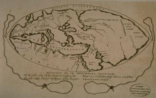
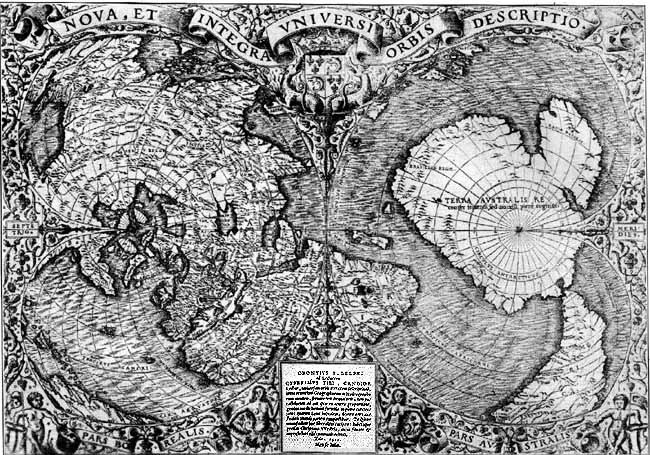
To 1531 dates the world map of Orontius Phineas, a map compiled by assembling dozens of other maps, forming the coastlines of all lands almost as precisely as we know them today.

There is another story bordering on legend, that of Father John or Pater Johannes. The priest was sent by Innocent the Third to convert a distant people, many believed it to be the Indies, but it seems that the destination was quite different, in the Vatican are, preserved documents from the library of Alexandria or Ishmaelite libraries (the Templars had numerous contacts with the sect of the Assassins), which would have allowed Pope Innocent III to learn of the existence of the lands beyond the ocean, the Templars themselves built their largest port on the Atlantic, La Rochelle. was in fact transformed from a small fishing port to a fortified city. Pater Johannes himself therefore set out for America, but his letters went unanswered when Innocent III was succeeded by Honorius III who was unaware of the mission.
As if all this were not enough the legends of the Mormons say that their ancestors came from a land beyond the Pillars of Hercules, there are in fact several similar words between the Hebrew language and some languages spoken in Central America. Was it Columbus who discovered America, or did someone before him discover Europe?
An eternal conflict, then, between truth and conservatism. How long should this unnecessary conflict last? Who wants the ignorance of the people? What does our remote past conceal?